Lucky Downloads          


Strict

Search results for 'depth map'.
201 products found. Showing 11-22 in 10 groups sorted by relevance.


11. Upgrade to Cartopro Evolution
You can switch map during simulation or when displaying track elevation. _by the menu Display this position on another map Many display options added. Display trace automatically while editing and after having switched to another map.
Details   Buy now ($41.71)   Find similar
Platform: Windows 95, Windows NT, Windows 2000, Windows XP, Windows 98, Windows ME, Windows Server 2003
Language: English, French
Vendor: Alain Sigrist

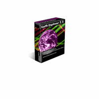
12. Earth Explorer
Earth ExplorerEarth Explorer integrates high-resolution satellite imagery (1km resolution) with kinds of map layers such as political boundaries, coastlines, rivers, lake and island boundaries, 267 countries and regions, 40000+ ranked cities, 15000+ islands, and 1700+ noteworthy historical earthquakes since 1980 into a fantastic 3D earth globe. You can specify what kinds of map layers to be shown, rotate the globe, click right mouse button and pull/push to zoom in/out the current map view, measure distance between any two points on the map, etc. Key features: 1. A 3D bird's-eye view of our beautiful earth; 2. Photo-realistic satellite imagery at 1km resolution covered entire earth globe; 3. Integrates with several kinds of map layers: Vector map layers: 1) Political boundaries (International boundaries and internal boundaries); 2) Coastlines, lakes, islands and rivers; 3) Longitude-latitude grids; Point map layers: 1) 267 countries/regions and detailed information; 2) 40000+ ranked cities and information; 3) 15000+ Islands and information; 4) 1700+ noteworthy historical earthquakes since 1980 and detailed information; 4. Rotate/Zoom in/Zoom out functions lets you observe our beautiful planet at any point (Click right mouse button and pull/push to zoom in/out the current map); 5. Three kinds of operation modes (Drag, Center, Measure); 6. Measure distance between any two points on the globe; 7. Intelligent tips when your mouse moves upon a country/city/island/earthquake's mark or name label; 8. Sort country/city/island/earthquake table according to selected titles and interactive operate with the label and mark on the map; 9. Save favorite maps with BMP, JPEG formats; 10.Realtime online database access and cache mechanism support fast and fluent exploration;
Details   Download trial   Buy now ($29.95)   Find similar
Platform: Windows NT, Windows 2000, Windows XP, Windows 98, Windows ME, Windows Server 2003
Vendor: Motherplanet

13. Analyzer Recording
AVI recorder, capturing an image from any window, recording under condition of a modification of an image. Plus - write time of a frame mapped in titles of a videoclip.
Details   Download trial   Buy now ($20.00)   Find similar
Platform: Windows 95, Windows 2000, Windows XP, Windows 98, Windows ME
Vendor: FreeStone Group

14. Coordinate Calculator ver 2.01
Powerful geodetic calculator. More than 200 sheroids and map projections. According to Defense Mapping Agency(USA)(now NIMA) Technical Report.
Details   Download trial   Buy now ($59.00)   Find similar
Platform: Windows 95, Windows NT, Windows 2000, Windows 98, Windows ME
Vendor: Victor Nekrasov

15. SharkPoint v1 for Windows (Palm companion)
SharkPoint v1 for Windows (Palm companion)SharkPoint for Windows is an inexpensive, easy to use, and full-featured diver's logbook. You can easily find data and review trends in your diving to answer questions like What depth do I most frequently dive to, and how long do I typically stay there? or Has my overall air consumption become better lately?
Details   Download trial   Buy now ($44.95)   Find similar
Platform: Windows 95, Windows NT, Windows 2000, Windows XP, Windows 98, Windows ME
Vendor: DreamDives
         16. SharkPoint v1 for Windows (PocketPC companion)
         Details   Download trial   Buy now ($44.95)   Find similar

17. CodeThatTree PRO
CodeThatTree PRO is a crossbrowser javascript tree control. Unlimited depth, XML integration, support for CSS styles, open API and other advanced features enable you to create state-of-art navigation system for your site.
Details   Buy now ($49.00)   Find similar
Vendor: CodeThat.Com

18. Earth Explorer DEM
Earth Explorer DEMEarth Explorer DEM integrates high-resolution shaded relief topographic imagery (built from 1km resolution digital elevation model) with kinds of map layers such as political boundaries, coastlines, rivers, lake and island boundaries, 267 countries and regions, 40000+ ranked cities, 15000+ islands, and 1700+ noteworthy historical earthquakes since 1980 into a fantastic 3D earth globe. You can specify what kinds of map layers to be shown, rotate the globe, click right mouse button and pull/push to zoom in/out the current map view, measure distance between any two points on the map, etc. Key features: 1. A 3D bird's-eye view of our beautiful earth; 2. Photo-realistic shaded relief topographic imagery at 1km resolution covered entire earth globe; 3. Integrates with several kinds of map layers: Vector map layers: 1) Political boundaries (International boundaries and internal boundaries); 2) Coastlines, lakes, islands and rivers; 3) Longitude-latitude grids; Point map layers: 1) 267 countries/regions and detailed information; 2) 40000+ ranked cities and information; 3) 15000+ Islands and information; 4) 1700+ noteworthy historical earthquakes since 1980 and detailed information; 4. Rotate/Zoom in/Zoom out functions lets you observe our beautiful planet at any point (Click right mouse button and pull/push to zoom in/out the current map); 5. Three kinds of operation modes (Drag, Center, Measure); 6. Measure distance between any two points on the globe; 7. Intelligent tips when your mouse moves upon a country/city/island/earthquake's mark or name label; 8. Sort country/city/island/earthquake table according to selected titles and interactive operate with the label and mark on the map; 9. Save favorite maps with BMP, JPEG formats; 10.Realtime online database access and cache mechanism support fast and fluent exploration;
Details   Download trial   Buy now ($39.95)   Find similar
Platform: Windows NT, Windows 2000, Windows XP, Windows 98, Windows ME, Windows Server 2003
Vendor: Motherplanet

19. Lenscare for After Effects (professional License)
Lenscare for After Effects (professional License)Our Lenscare plugins move depth of field and out of focus generation to post production.
Details   Download trial (Full version: 432.1 KB)   Buy now ($176.00)   Find similar
Platform: Windows 95, Windows NT, Windows 2000, Windows XP, Windows 98, Windows ME
Vendor: Frischluft
         20. Lenscare for After Effects, Mac (site License)
         Details   Download trial (Full version: 432.1 KB)   Buy now ($555.00)   Find similar

21. CompeGPS Pocket Air in CD-Rom
You will enjoy most of the CompeGPS PC version functions, like the waypoint and routes creation and edition, full GPS and Pocket PC communication, use of digital maps and moving map (real time navigation), to obtain the most of your flights.
Details   Buy now ($125.12)   Find similar
Platform: Win CE / Pocket PC
Language: English, German, Spanish, Italian, French
Vendor: CompeGPS Team, SL

22. Lenscare for After Effects, Mac (professional License)
Lenscare for After Effects, Mac (professional License)Our Lenscare plugins move depth of field and out of focus generation to post production.
Details   Download trial (Full version: 432.1 KB)   Buy now ($176.00)   Find similar
Platform: Mac OS 9/Classic, Mac OS X, OS9 + OSX
Vendor: Frischluft

First page Next page


Strict

Natural Linguistics
Network & desktop search | Search My Network | LAN Find | Reminder software | Software downloads | WordNet-Online dictionary | Thesaurus | CV
Access us via www.LuckyDownloads.com or www.L-DL.com
Copyright © 2005 Lucky Downloads